Sivas Province
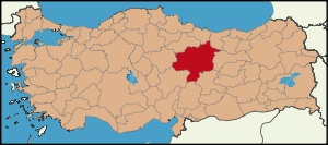
| Location of Sivas Province in Turkey | |
|---|---|
 |
|
| Overview | |
| Region: | Central Anatolia Region, Turkey |
| Area: | 28,488 km2 (10,999 sq mi) |
| Total Population | 810,989 TurkStat 2007 (est) |
| Licence plate code: | 58 |
| Area code: | 0346 |
| Governor Website | http://www.sivas.gov.tr |
The province of Sivas is located at the eastern part of the Central Anatolian region of Turkey; it is the second largest province in Turkey. Its adjacent provinces are Yozgat to the west, Kayseri to the southwest, Kahramanmaraş to the south, Malatya to the southeast, Erzincan to the east, Giresun to the northeast, and Ordu to the north. Its capital is Sivas.
The majority of Sivas Province shares the climate of the Central Anatolian Region in which the summer seasons are hot and dry while winter seasons are cold and snowy. However, the northern part of the province shares the Black Sea Climate while the eastern portion shares the climate of the Eastern Anatolian higher region.
This province is noted for its thermal springs.
Districts
Sivas province is divided into 17 districts (capital district in bold):
|
|
History
The route of the Silk Road and the Persian Royal Road run through Sivas.
According to the written historical sources, the region of Sivas province was first inhabited during the period of the Hittite civilization by the beginning of 2000 BC and became an important settlement. The region then encountered the reign of Phrygian, Lydian, Assyrian, Roman, Byzantine, Seljukian, Danişment, Ilhanlı, Eretna and Ottoman civilizations.
The foundations of the modern Turkish Republic were laid in the Sivas Congress assembled on 4 September 1919, during the presidency of Mustafa Kemal Atatürk, thus making the province of Sivas important to the history of the Turkish nation.
External links
- Sivas News - Sivas News
- Sivas Gazete - Online news about Sivas
- Sivaslılar Vakfı - Everything about Sivas and Sivas Culture
- Bizim Sivas - Sivas' Biggest Local Newspaper
- The Football Team of Sivas City - Sivasspor - supporters meet here
- Sivas Kültürü - Cultural Informations about Sivas city
- Introduction Video Sivas source maxivideo.net
|
||||||||||||||||||||||||||||||||||

|
|||||||
| This article about a Central Anatolia Region of Turkey location is a stub. You can help Wikipedia by expanding it. |